All Articles
Introducing Orca Premium
July 31, 2023 • 3 min read
The best navigation functionality for your personal tablet and phone.

Orca Premium is the best way to experience Orca.
It lets you download charts for offline use, view high-resolution satellite imagery, automatically calculate sail routes, and give you smart rerouting – similar to what you have in your car.
Orca Premium is available for owners of the Orca Core or Display – and also for those who just want to use Orca on their smartphone and tablet. The base functionality of Orca for smartphones and tablets will always be free.
Comparing Premium with Free
The free version of Orca contains a lot of great tools for boaters who do shorter trips and stay inside cellular coverage. Orca Premium adds to that with more capable planning and navigation tools along with a fully offline navigation experience.

A deep dive into Orca Premium
Orca Premium gives you a lot of great functionality and benefits that make boating easier and more fun.
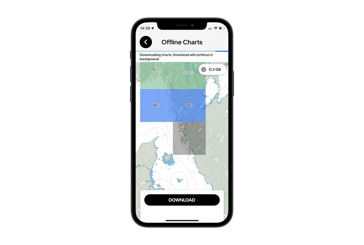
Offline charts and routing
The cornerstone of Orca Premium is access to offline charts and offline routing. It means you can go offshore, beyond cellular coverage, and still have access to all your charts and routes.

Orca Premium gives you access to Orca's complete cartography library. Download charts for offline access when you need them.
A great thing about Orca Premium is that you get access to the complete Orca chart portfolio. You can download charts as you go and you don’t have to make decisions about which charts to buy based on potential plans you may have in the future.
Satellite Hybrid Charts
These charts blend high-resolution satellite imagery with marine cartography and give you incredible situational awareness.
Satellite hybrid charts let you easily spot anchorages that are free from seagrass.
Satellite Hybrid Charts are excellent for preparing a harbor entry. They also make it easy to spot where other boats are anchoring in a natural harbor – while retaining navigation critical information, such as marks and rocks, in the chart.
Sail Routing
Sail Routing uses weather forecasts and polar diagrams to find the best path to your destination. When you ask Orca to find a Sail Route, Orca compares thousands of alternative routes to your destination and gives you the fastest route for your boat.
Orca finds a Sail Route across the British channel in just a few seconds. The turning tide causes the route to shift in an S-shape.
Sail Routing makes planning sailing trips incredibly easy. It also gives you an advanced timeline that shows you exactly how wind and currents change throughout the planned trip.
Orca's sail routing lets you quickly understand that you'll need a lot of tack on your way out of the Solent. Changing wave conditions and currents are also easy to spot.
Smart Navigation
Smart Navigation is the first truly intelligent navigation and routing system made for the sea. It is like having an extra navigator onboard who constantly follows your progress and updates your route.
With Smart Navigation, Orca understands when you deviate from your intended route and supports you when it happens.
Automatic Rerouting shows you the best path to your destination, even when you deviate from your intended route.
If you depart from your original route significantly, such as passing on the opposite side of an island, Smart Navigation will detect it and propose a better route.
If you decide to take a detour around an island, Automatic Rerouting will give you an updated route.
Smart Navigation allows you to focus on the journey, knowing that Orca finds the way even when things change.
AIS images
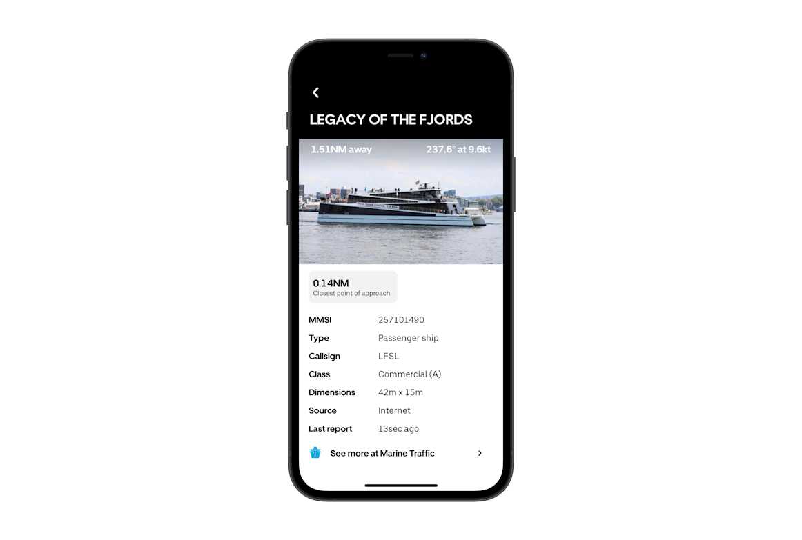
Internet AIS is available for all users in Orca, and if you have an Orca Core, you’ll be able to view AIS targets from your local AIS receiver. AIS is a great safety tool, but figuring out which AIS target represents an approaching vessel can be tricky – particularly in busy areas.

Legacy of the Fjords is easy to identify with its characteristic shape.
Orca Premium lets you view photos of AIS targets inside Orca. This lets you easily correlate the approaching vessel with the target in the chart, and you can check MarineTraffic for more in-depth information about the vessel.
How to get Orca Premium
If you don’t own an Orca Display or Core and want Orca Premium, head to the Orca Account Website and log in with your Orca account. From there you’ll be able to set up and manage your subscription.
Orca Premium is €119 / year. For more in-depth information about it, see the user guide article.
Owners of Orca Display and Core can use the Orca Account Website to check their subscription status. Owners will also be notified via e-mail when Orca Premium is about to expire, giving you time to keep it active throughout the season.


