All Articles
Explore with Satellite Hybrid Charts
May 23, 2022 • 3 min read
Introducing Satellite Hybrid Charts, a better way to explore and plan trips.
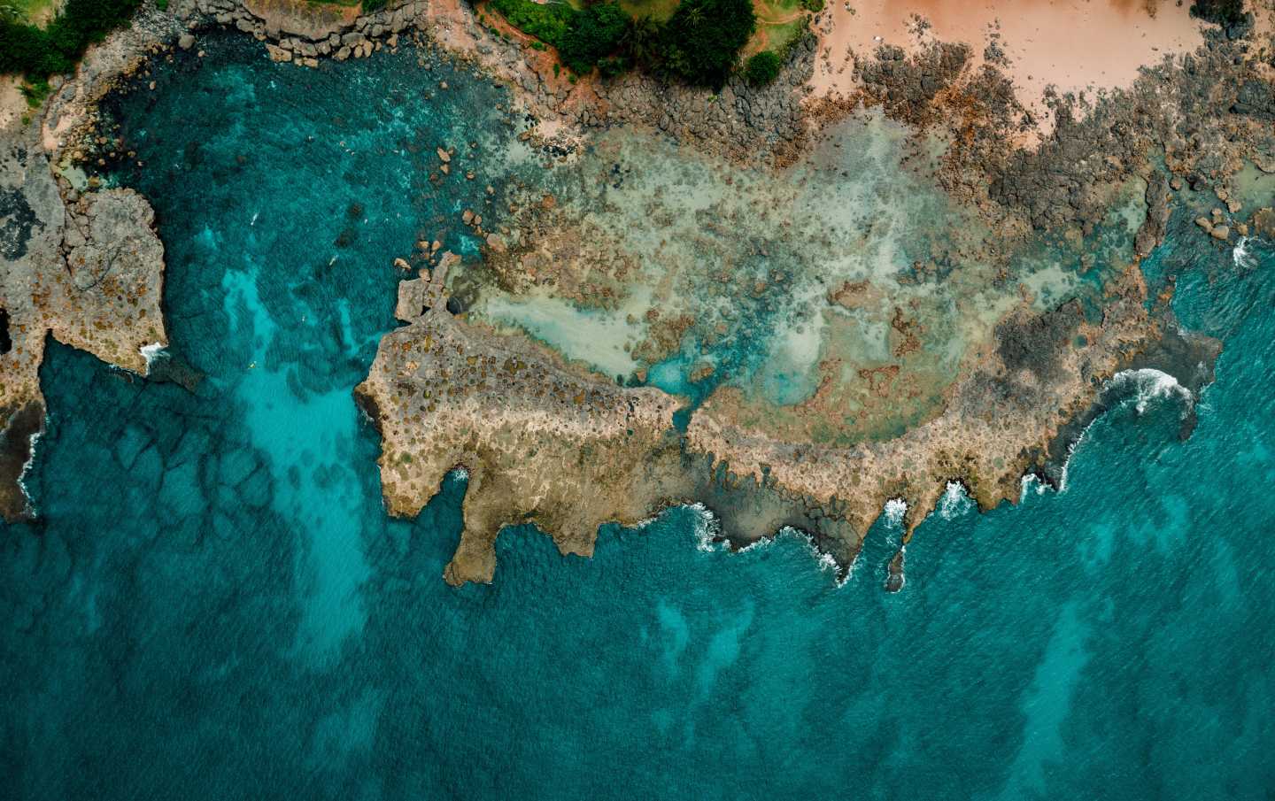
Boating is all about exploration and adventures on the water. Traditional marine charts are designed to distill critical navigation information: Hazards, depth of water, shoreline, navigation features, and information about notable features.
But traditional charts have one inherent weakness: Charts abstract away so much information that they can be hard to translate into the real world.
For instance, during a harbor entry – it can be hard to get a sense of the scale of the harbor, the piers, and noteworthy landmarks, by just looking at marine charts. It's also hard to relate crucial features, such as an underwater rock relative to a landmark, like a building by the shoreline.
High-resolution satellite imagery solves this problem.
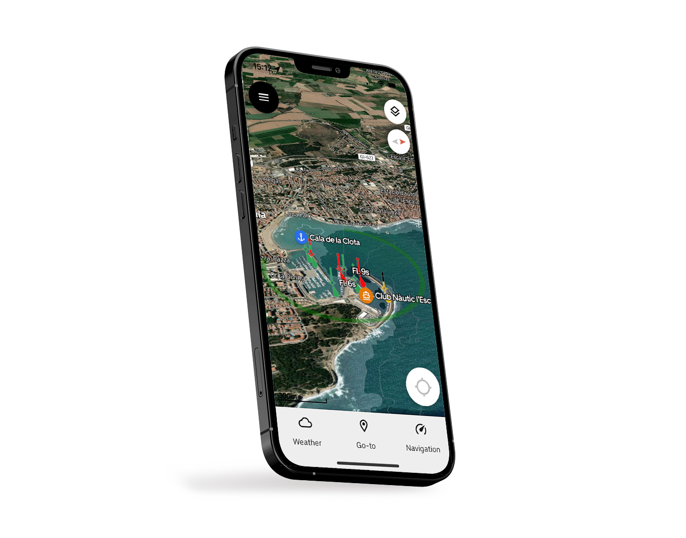
Orca's new marine satellite layer blends nautical charts with satellite imagery
Most of us are familiar with shore-based smartphone navigation apps like Google Maps. These apps have traditionally given users the option of viewing different layers on their map, including roads, terrain, and high-resolution satellite photos.
Before Orca, marine navigation products hadn't been able to offer that level of quality.
Even the most expensive chartplotters on the market don’t offer high-resolution satellite imagery. At best, you'll experience a coarse, outdated, and low-resolution image that doesn't offer much value.
Introducing satellite hybrid charts in Orca
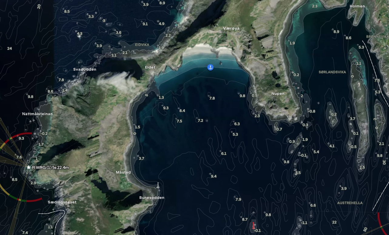
Satellite hybrid charts help you understand the surroundings while keeping navigation-critical information in the chart.
High-resolution satellite charts is one of the fantastic features of Orca. These charts blend satellite and aerial imagery with marine chart data to give you a beautiful and high-resolution view of the world around you.
To view satellite charts, open the Control Center from the button in the top right corner of your chart and select Satellite. You’ll now be able to identify seabed types, review coastlines for sandy beaches, spot potential anchorages, and scout ahead for interesting landmarks, hills that disrupt wind, and the topology of an island.
Better exploration
For adventurous boaters, satellite imagery adds an extra dimension of depth to exploration and trip planning that you can't achieve with traditional marine charts.
You can identify great beaches and find anchorages by looking at where other boats have moored or anchored. You'll also be able to explore how scenic a particular route is and which islands and bays look interesting for heading onshore.
Because the Orca satellite imagery also shows important navigation information on top of the satellite charts – you'll always be able to understand the navigation complexity for the area you're viewing. The age of cross-referencing between Google Maps and your favorite marine charts is finally over.
Safer pre-planning
Many times, a photograph will reveal details that a traditional nautical chart doesn’t reveal.
It can be the exact shape and topography of a reef or the shape of a rocky shore where it may be suitable for mooring your boat. What about the seabed in a bay – is it sandy or rocky? Which anchor should I use?
By reviewing satellite imagery while planning a trip, you're able to make more decisions up-front.
This means you have fewer things to worry about while underway and while anchoring or mooring – which frees up your mind to stay focused on nearby boats, the weather, and navigating according to plan.
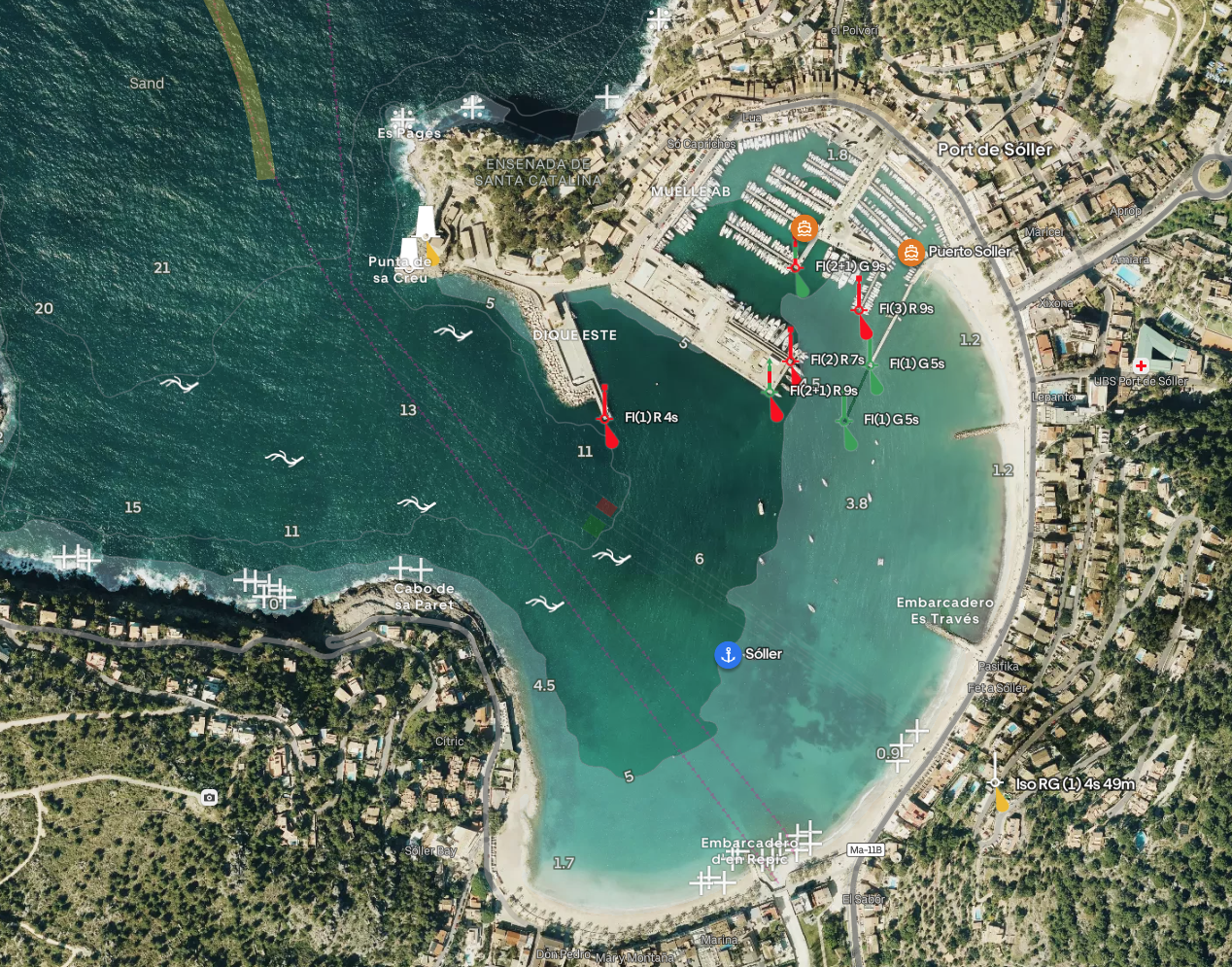
Satellite Hybrid Charts make planning a harbor approach effortless. View landmarks and get a feeling for your surroundings before you arrive.
The best display for Satellite Hybrid Charts
To get the most out of your satellite hybrid charts, you'll want a crisp and bright screen that is easy to view in direct sunlight.
Orca Display 2 is that screen. It is ultra-bright, handles warm and cold days with ease, and it makes navigation and planning truly enjoyable.
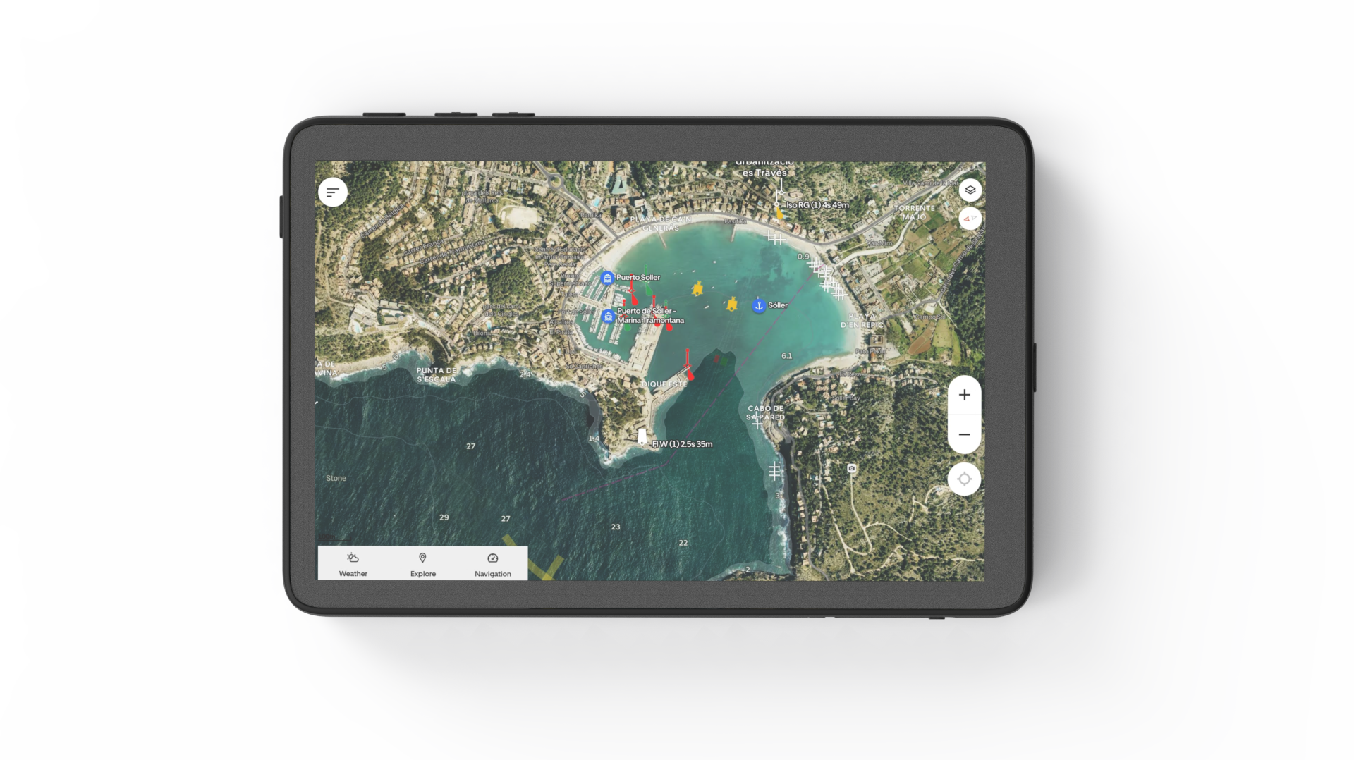
Orca Display 2 brings the best out of Satellite Hybrid Charts.
Order your Orca Display 2 today. Shipping is free, and we back every unit with our 30-day satisfaction guarantee.


