All Articles
Tips for Better Routing
November 8, 2024 • 4 min read
Get routes that fit your boating style.
Automatic routing is a fantastic tool for planning. It allows you to get ETAs, compare different route options quickly, and even check how the weather forecast will be along the route.
However, different boat types, regions, and weather conditions call for different routing practices. While Orca comes with great defaults, to get the very best experience, you should review and tweak Orca’s routing to match your preferences.
This guide will help you understand how each setting in Orca affects the routing behavior – so you can tweak it just the way you want it.
The Important Basics
When you first sign up with Orca, you’re asked a few questions about your boat – and Orca sets up its routing behavior based on these. The default options are great for the typical boater, but as you get more experienced with Orca, you likely want to start fine-tuning Orca’s routing behavior to match your style of boating. You control all your Route preferences via Main Menu > My Boat > Route Settings.
Depth Limit
The routing engine will attempt to avoid areas shallower than the Depth Limit you set. In cases where there’s no navigable route without entering shallow waters, Orca will still find a way to your destination, but it will display the shallow route section in red as a warning.
A general recommendation is to set the Depth Limit slightly deeper than your boat’s draft. For those navigating in unfamiliar or complex waters, you may want to add more depth as an extra safety margin.
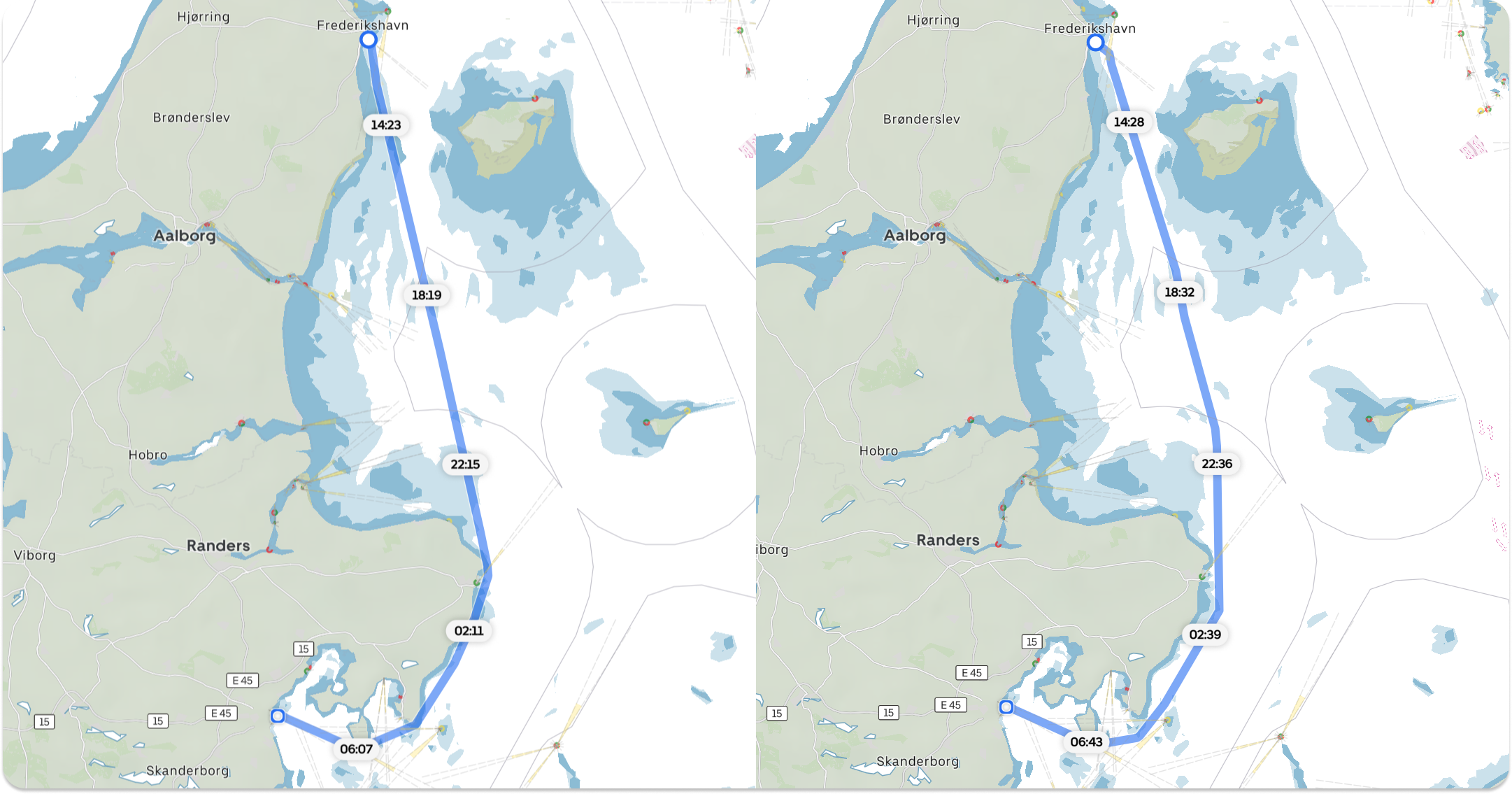
A trip from Fredrikshavn to Århus in Denmark. To the left, a depth limit of 1 meter makes the route follow the shoreline closely, crossing shallow sand banks. To the right, a depth limit of 10 meters. The route keeps further away from shallows but takes 40 minutes longer.
Height Limit
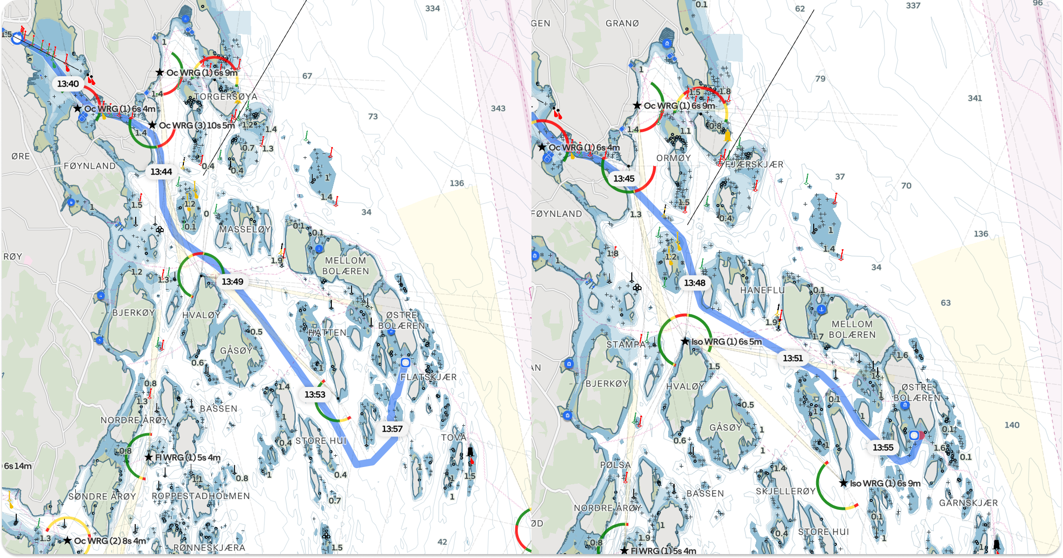
This option ensures Orca avoids bridges and overhead cables lower than the Height Limit you specify. Similar to the depth limit, it’s wise to add a bit of a buffer in case of arching bridges or sagging cables.
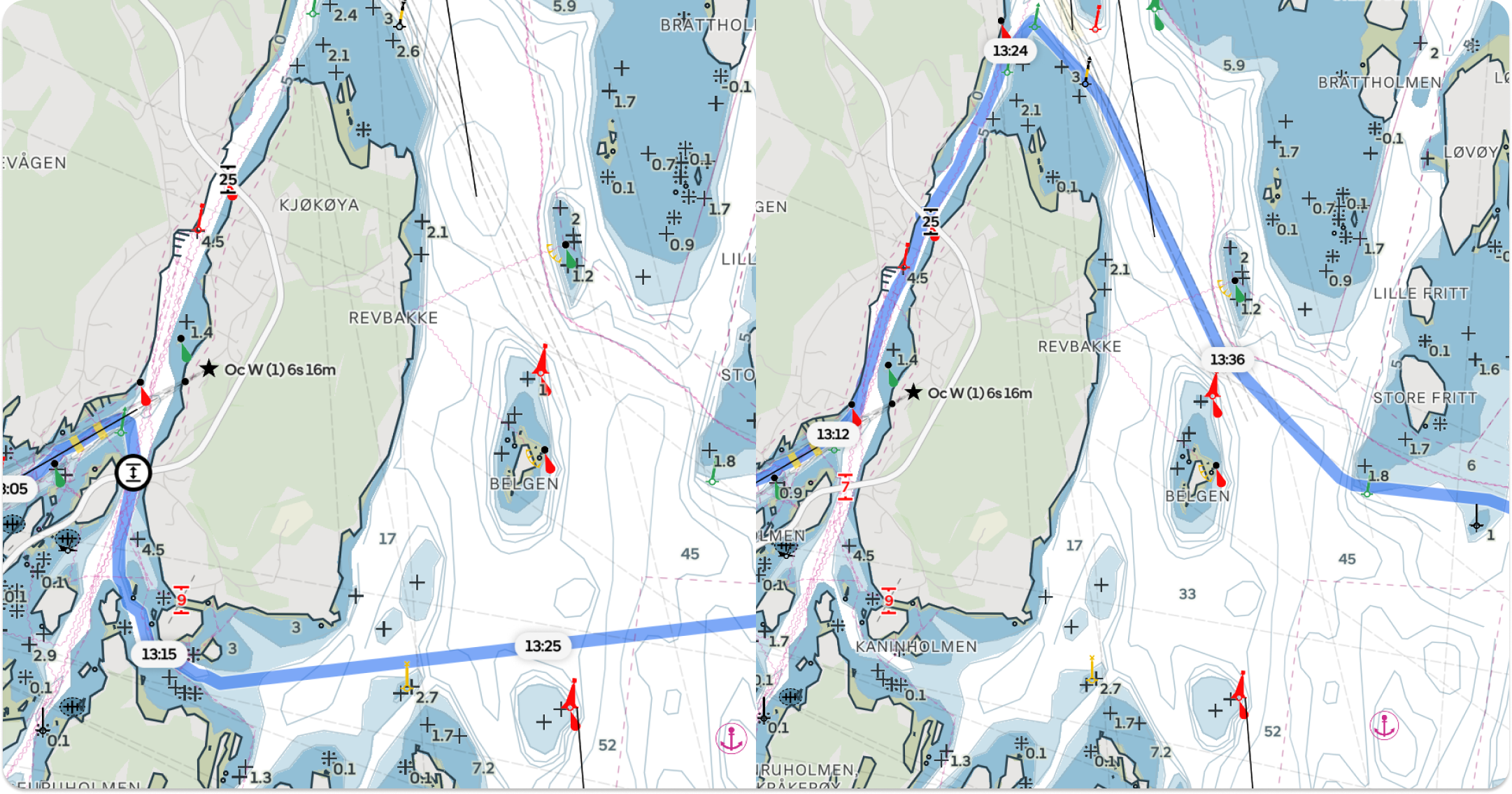
To the left, a Height Limit of 2 meters allows for passing under the 7-meter bridge southwest of Kjøkøya. With a higher Height Limit, the route follows the northern channel.
Boat Speed
Adjust the Boat Speed to reflect your actual cruising speed. Getting the boat speed right is important because accurate speed estimates lead to precise ETAs, which in turn determine the relevance of weather forecasts Orca will show along your route. Powerboat owners can specify different speeds for nearshore and open-water cruising to get even more accurate ETAs.
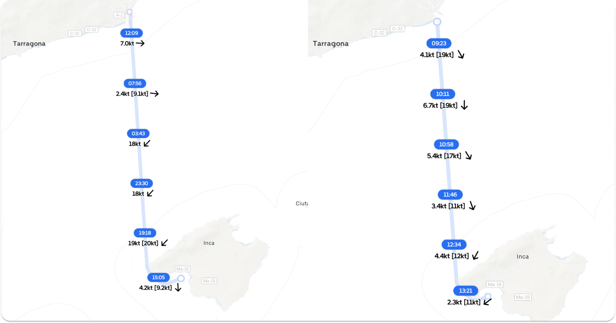
To the left, a sailboat going from Barcelona to Palma at 6 knots will have a windy trip. To the right, a fast powerboat cruising at 25 knots will outrun the bad weather.
Routing Leeway
Routing Leeway determines how far from shore Orca will attempt to route. Smaller boats or those traveling in sheltered waters may prefer to stay close to shore or between islands for sheltered passages, while larger vessels or boats going in open waters should increase Routing Leeway. Experiment with this setting to see what fits your navigation style.
To the left, a high Shore Distance Preference will prefer to stay in open waters. To the right, a lower distance preference will follow closer to shore.
Detailed Settings for Sailboats
Sail Routing is complex because it depends on the weather forecast, the performance of your boat, and your crew. Achieving precise Sail Routes can be challenging, but satisfying to get right. Here are some steps to help you get the most accurate sailing routes:
Select Your Polar Diagram
A polar diagram estimates your boat’s potential speed based on wind speed and angle, making it one of the most important things to get right when attempting to get accurate Sail Routes. You select your polars via Main Menu > My Boat > Polar Performance.
Orca lets you search in the Offshore Racing Committee Polar Database. If you have an ORC polar for your boat, search for your sail number, select it, and you are good to go.
If you don’t have an ORC polar, search for your boat type instead. The ORC database has more than 6000 sailboats and it's quite likely it contains your boat. If you are unlucky and your boat type is not in the ORC database, search for a similar boat type that aligns with your boat’s sailing performance. For instance, a Hanse owner might select a Bavaria that is similarly sized. As a last resort, try to find your boat’s polar diagram online and enter it manually in Orca.
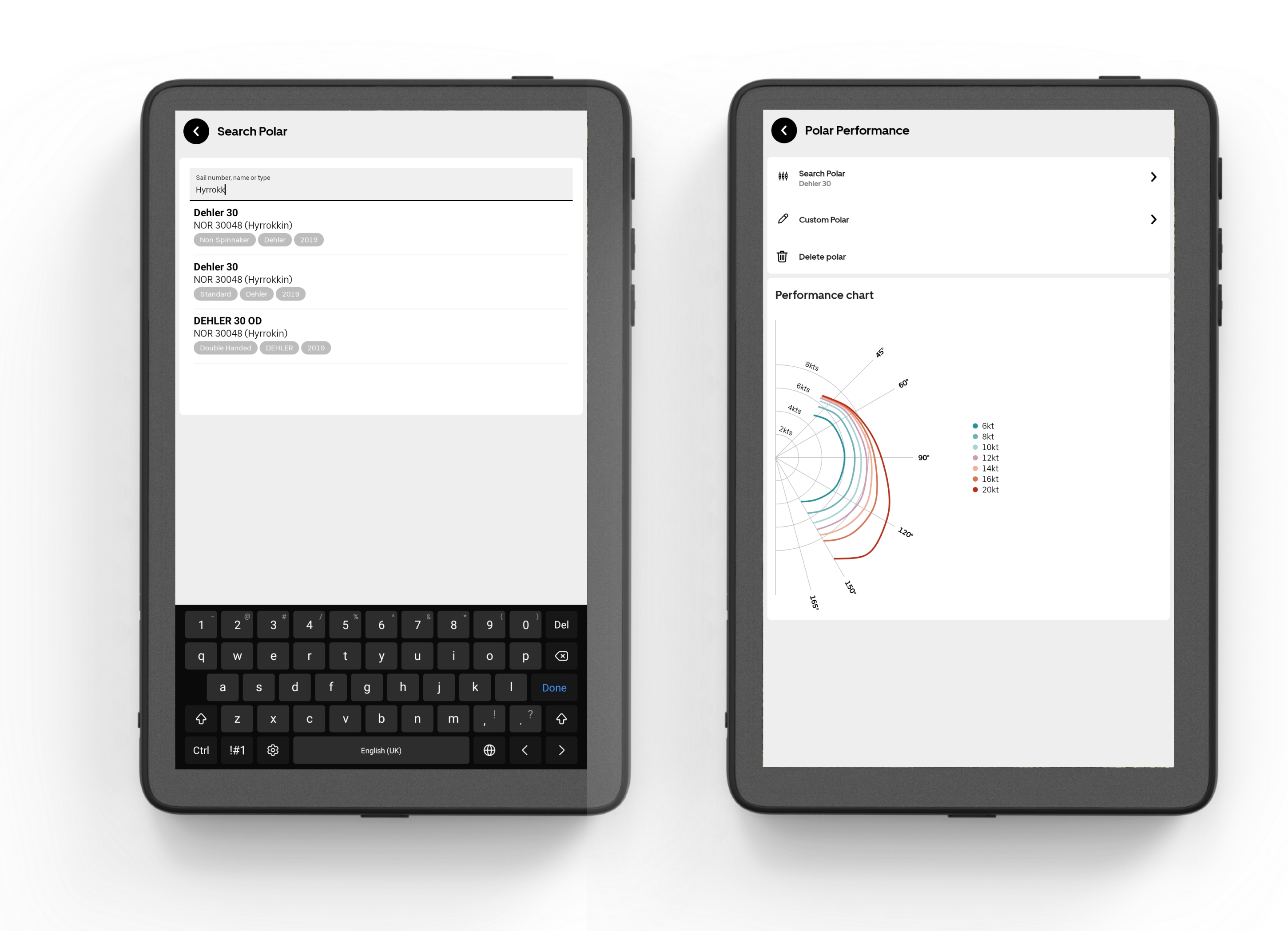
Search for polars in the official ORC database. Orca also includes non-spinnaker and shorthanded polars.
Fine-Tune your Polar
The polar diagram reflects your boat’s maximum theoretical speed, which is hard to reach in practice, in particular when sailing casually. To make Sail Routes match your actual sailing pace, you need to fine-tune the polar diagram to your actual sailing performance.
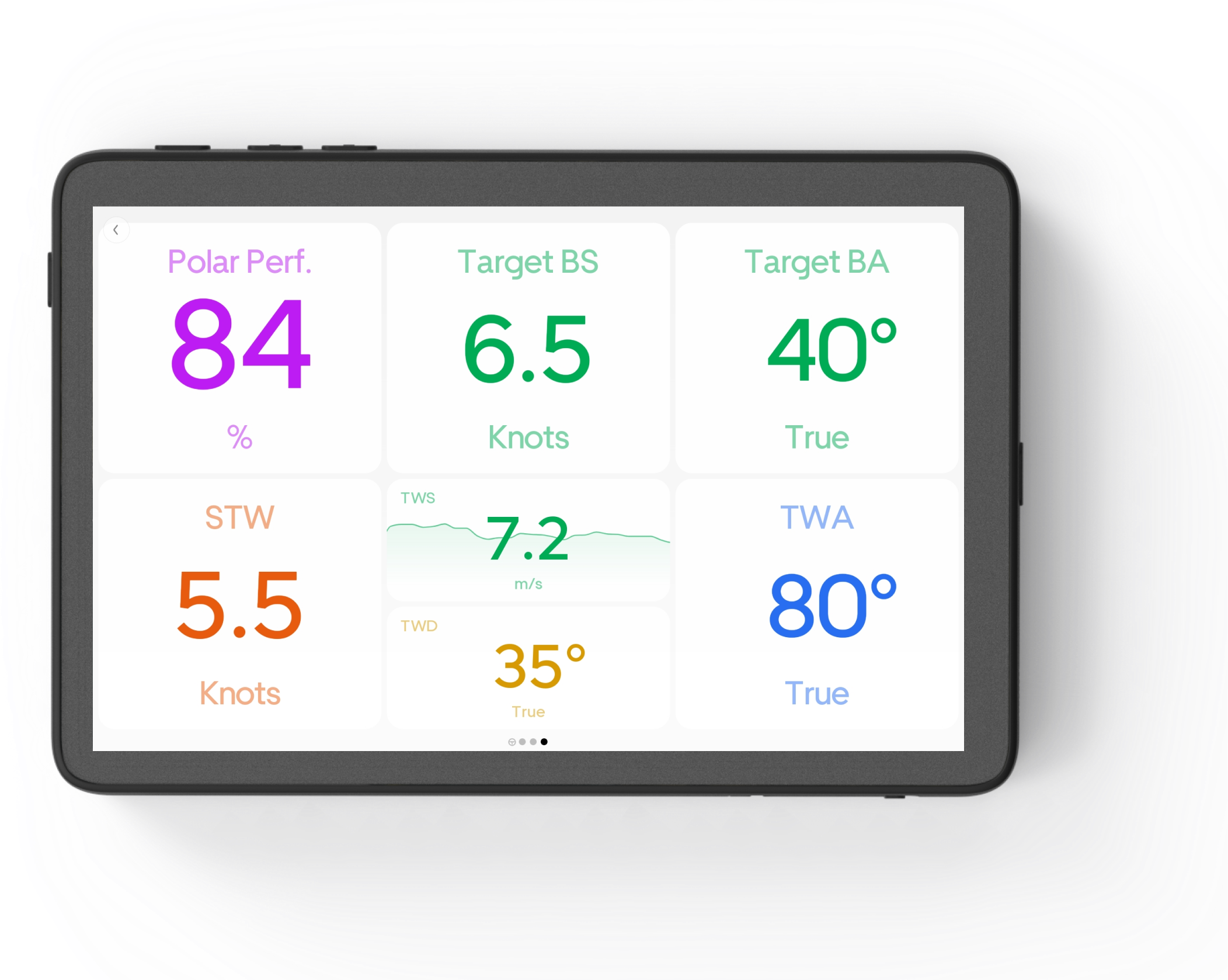
A great example of polar instruments that let you compare your actuals against your polar targets.
The best way to track your actual sailing performance is to add a Polar Performance and Target Beat Angle instrument to your sailing instrument panel. This way, you can keep track of your typical sailing performance versus your maximum theoretical speed and beat angle. Once you have tracked your typical performance, adjust your Polar Scaling and Beat Angle Offset accordingly.
Even the most experienced sailing crews sail slower at night. To compensate for this, you can adjust your polar night scaling. This reduction is only active from dusk till dawn. For those looking to learn more about polars, read Orca’s Polar Performance guide.
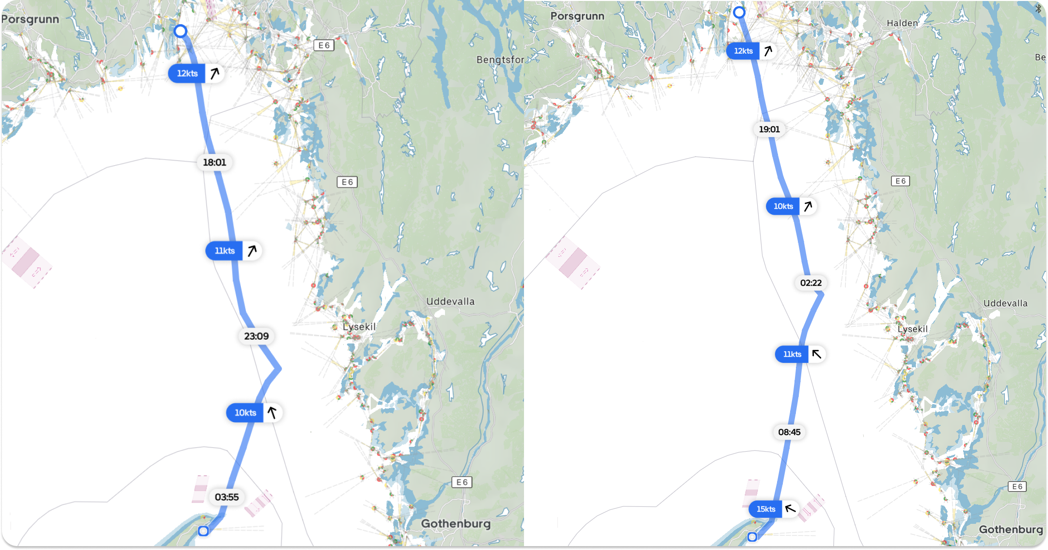
A night sail from Tjøme Norway to Skagen in Denmark. To the left, 100% Polar Scaling. To the right, 80% scaling at day, with an additional 80% scaling at night. With reduced polar scaling, the tack is further north and arrival is 7 hours later.
Minimum Wind Speed
In light wind conditions, Orca automatically switches to engine routing if the wind drops below your set minimum wind speed. This setting is ideal for sailors in low-wind regions who want to maximize sail time while still having the engine available if progress slows. Those who are racing can turn this off.
Effortless planning meets accurate navigation
Orca’s Routing makes planning boat trips effortless. Routing makes it incredibly easy to understand what weather conditions you will face and when you will arrive at your destination. For the very best routing experience, you should also get an Orca Core.
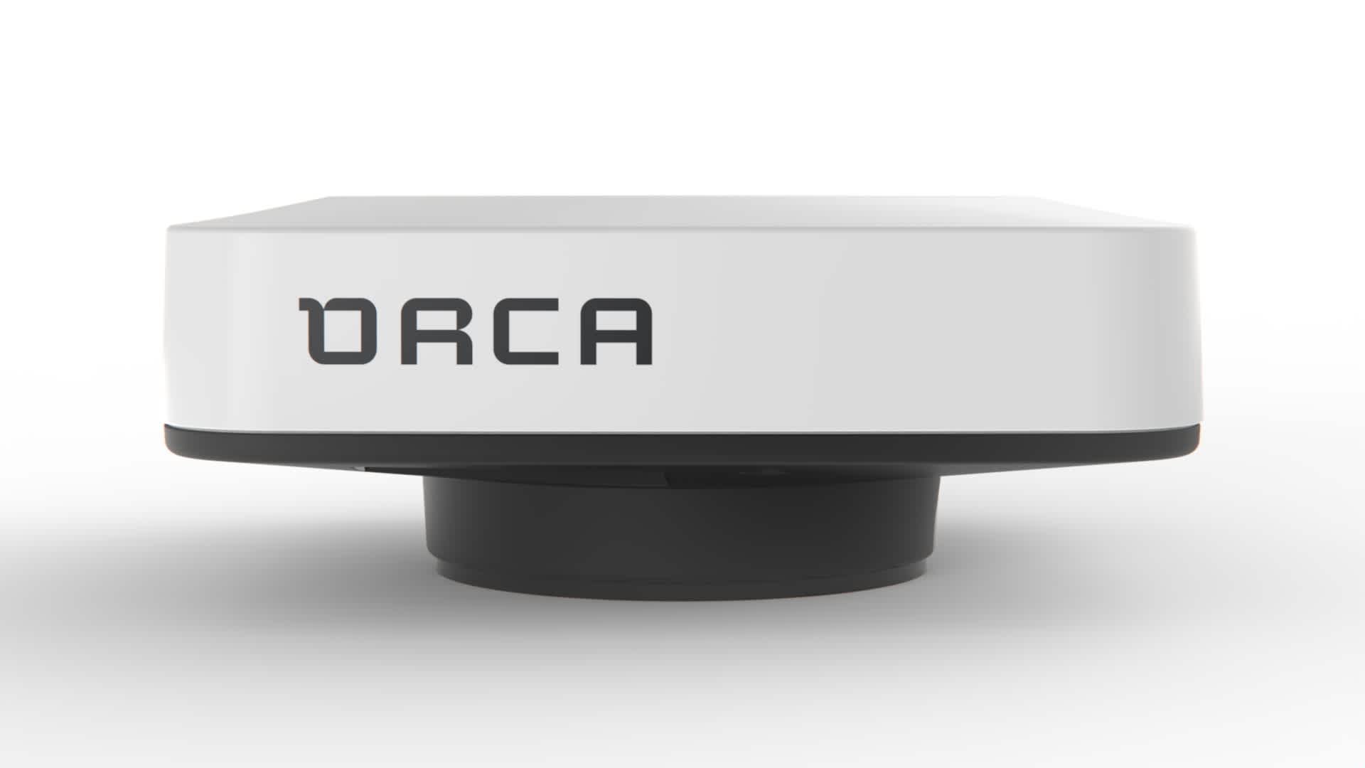
Orca Core 2 delivers high-end chartplotter functionality to your phone, tablet, computer, and watch.
With the Orca Core, you’ll get access to automatic rerouting, which will refine your routes while you navigate. The Core also comes with advanced boat integration with sensors, radar, and autopilot control – along with incredibly accurate GNSS positioning for better ETAs and safety.
Order today from the Orca Store with Orca’s 30-day satisfaction guarantee and try the complete Orca experience risk-free.


