All Articles
Navigate safer with enhanced AIS data
May 6, 2022 • 2 min read
Navigate safer with enhanced AIS monitoring, TCPA and CPA.

Today's update is one step further towards making the Orca CoPilot more contextual-aware: The AIS system in Orca has now been upgraded.
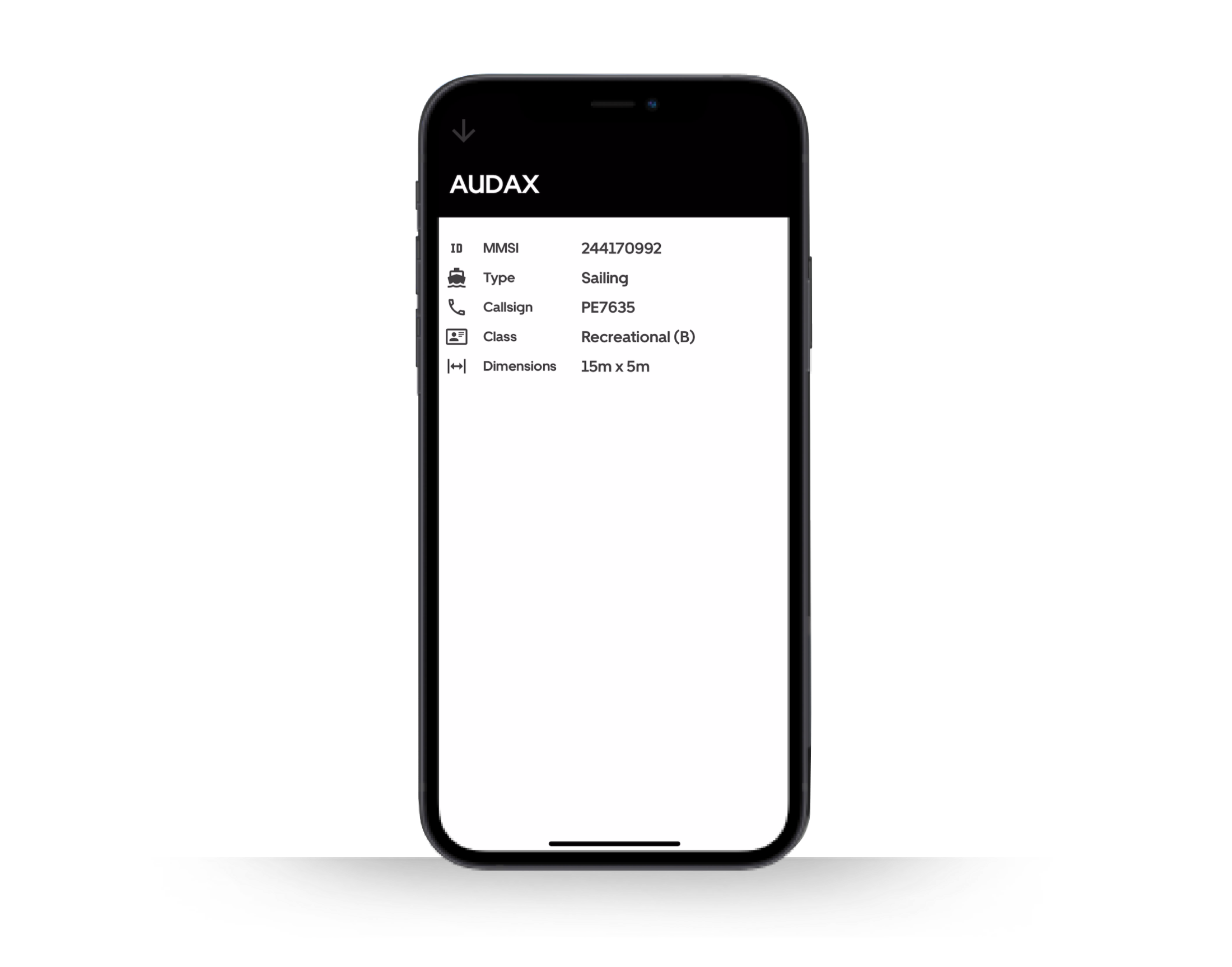
You can now tap on AIS targets to bring up additional information.
AIS is short for Automatic Identification System. It is an automated tracking system that allows vessels to broadcast their location, speed, and heading to other nearby vessels.
An AIS system has many uses, but its main purpose is safety and collision avoidance.
AIS to boaters worldwide
Traditionally, you could only view AIS information on a chartplotter via a dedicated receiver onboard.
Orca is not a traditional chartplotter. With this update, we’re bringing AIS to all users of the Orca CoPilot – and all you need is a cellular internet connection.
Orca now connects to a global cloud-based AIS data-sharing community. That's a mouthful – but in brief – we receive AIS information from AIS base stations and vessels around the world and in return share data from our users with AIS receivers.

Get detailed information from AIS targets.
As a result, you will now be able to view AIS targets in Orca without having an AIS receiver onboard. Better yet, the more boaters who use Orca and own an AIS receiver, the better AIS coverage the entire Orca community gets.
If you do have an AIS receiver onboard, Orca will merge data from nearby base stations and vessels with what you receive from your local receiver – allowing you to view vessels outside your receiver's reception range.
How does AIS benefit me?
Having access to AIS data onboard makes it much easier to avoid close passings and potential collisions, in particular with fast-moving commercial vessels.
The AIS data transmitted by each vessel includes that vessel’s destination, ETA, course, and current speed.
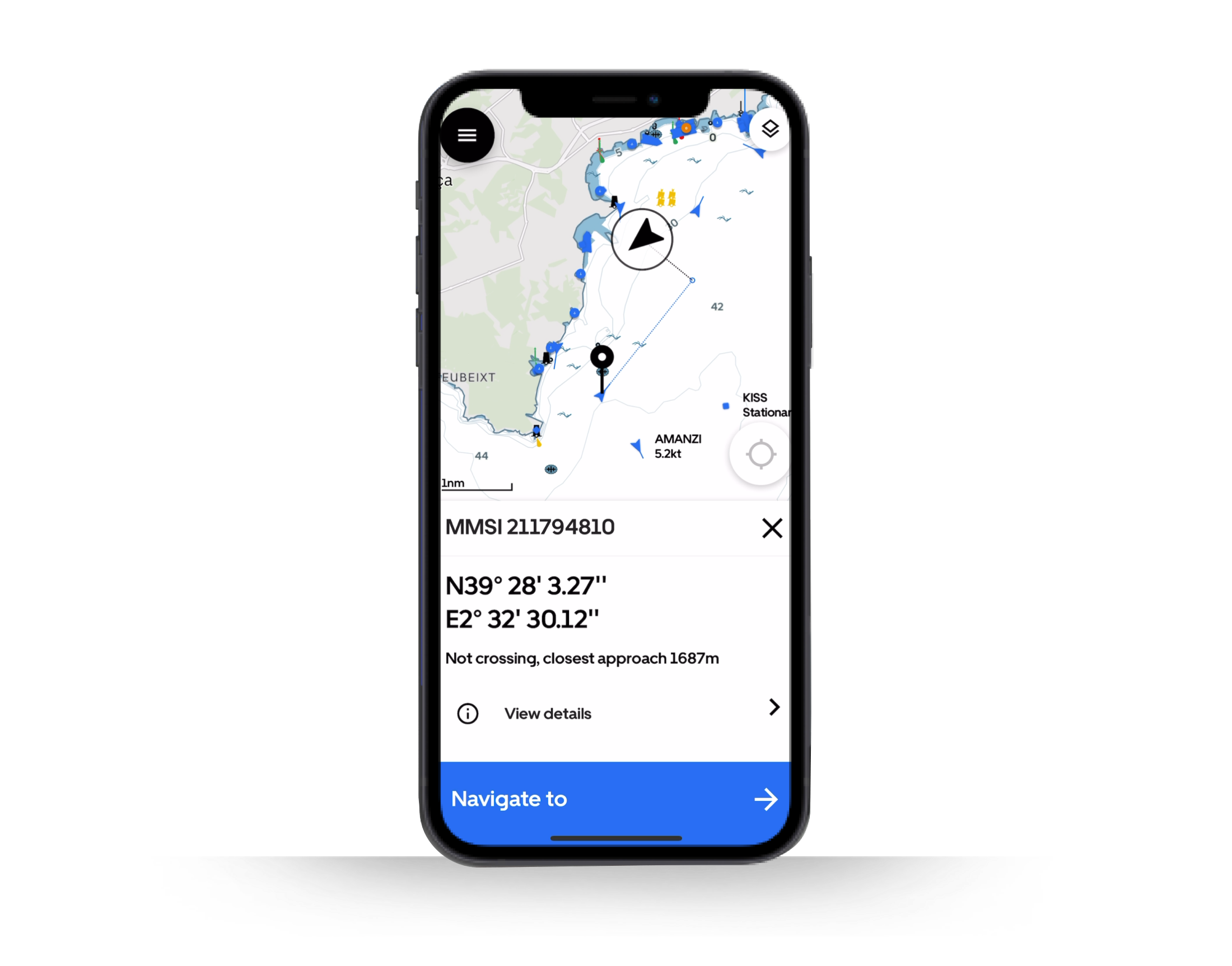
Orca will show those vessels and their speed and course in the chart as blue vessel icons and an aim line that shows how far the vessel will travel in the next 10 minutes.

Enhanced AIS shows you CPA and TCPA.
When you select a vessel in the chart, Orca will also display its Closest Point of Approach (CPA) and its Time to Closest Point of Approach (TCPA).
CPA displays the point at which your boat and the target vessel, will be closest to one another. Orca marks the CPA with a blue circle in the chart and dashed vectors from your vessel and the target vessel as seen above.
TCPA tells you how much time it takes for you and your target to reach the closest point of approach.
If the CPA for another vessel is too close for comfort, you can change course early to reduce the risk of a stressful encounter.
Do I still need an AIS transceiver if I have Orca?
Yes and no. First and foremost, if you want to be visible on other vessels' traditional AIS systems, you'll need a dedicated AIS transceiver. Orca is not a replacement for an AIS transceiver.
If you just want to share your location with other Orca users, then you will not need a transceiver, as Orca will automatically share your location when you are at sea and connected to a Core.
Got questions about AIS or compatibility with AIS receivers?
Send us a message via the app or e-mail us at hello@getorca.com, and we'll help you out.


